
Public weather services
MetService provides public weather forecasting and monitoring services across Aotearoa 24 hours a day, 7 days a week, 365 days a year.
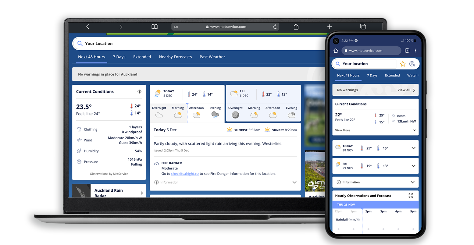
New Zealand Weather Forecasting
MetService provides forecasts for all of New Zealand including urban, rural, marine, and mountain forecasts. Our forecasts are produced using a combination of high-resolution weather modelling and expertise from our team of experienced meteorologists and delivered through our apps and metservice.com.
Towns & Cities
Urban forecasts for towns and cities across the country. These pages show written forecasts prepared and monitored by our team of meteorologist as well as useful tools like the 48-hour model, current conditions, summer UV, laundry drying time, pollen forecasts, tides, sun and moon information, and more.
Rural
Our rural forecast pages show similar information to urban forecasts but feature broader regional forecasts describing weather around the region alongside hourly model data, rainfall exceedance, probability forecasts, and soil condition data (where available).
Marine
MetService provides a wide range of marine information including:
Model forecasts for Boating, Surfing, Paddleboarding, Kayaking.
Marine maps (Sea surface temperature, Significant wave height, Peak wave period, Sea surface temperature anomaly)
Mountains & Parks
Our national park pages forecast weather conditions and highlight mountain weather hazards. This includes avalanche risk and spot data at huts across various altitudes. Ski Field pages provide details about weather and snow conditions as well as Ski Field status information.
Maps & Radar
Weather maps provide a visual depiction of upcoming and observed weather. MetService maps include 3-Day and 5-Day Rainfall, Surface Pressure, and Rainfall Accumulation. This section also includes Satellite and Rain Radar imagery.
Severe Weather Warnings
The latest MetService Severe Weather information displayed on interactive maps.
Weather Observation
Before we can look to the future, we need to understand the present. MetService operates a comprehensive observing network over and around New Zealand helping to build a picture of the current weather conditions across the motu.
Rain Radar
MetService operates New Zealand’s network of radar stations. The network of 10 radars provides extensive coverage and real-time information on rainfall and other precipitation across the country.
Automatic Weather Stations
A network of over 200 Automatic Weather Stations (AWS) reaches from Cape Reinga in Northland, to Southwest Cape on Stewart Island. These stations send back the latest information on temperature, rainfall, air pressure, wind speeds, and several other weather parameters depending on the needs of that particular site.
Satellite Weather Imagery
MetService works alongside the Japanese Meteorological Agency (JMA) to share the most recent JMA satellite imagery, showing New Zealand and the Tasman Sea from above.
Upper Air Observations
Daily radiosondes (weather balloons) provide information on the vertical structure of the atmosphere, helping our forecasting team build a 3D picture of the atmosphere. The data from these balloons feed into international weather and climate models as part of our commitment to the World Meteorological Organisation.